Toyota announces “game changing” 10-inch HD Map resolution from satellite photos — 30-year-old DoD technology can get it down 5X smaller
Just after announcing they have little idea how to make a self-driving vehicle, Toyota announces they can use high definition satellite data to make HD Maps down to 10-inch resolution. DoD technology can get it to two inches.
https://www.cnet.com/roadshow/news/toyota-self-driving-car-mapping-system-satellite/
All you have to do to get it is find folks with the tools and knowledge of how to do it. Like us. And from that we can make LiDAR point clouds to match any LiDAR or one 10X better. And detailed simulation databases are just a touch more work.
STOP thinking this industry innovates everything and no one else has done a thing. You are wasting massive amounts of time and money.
More of my articles here
Gill Pratt, Toyota, Waymo and FiveAI confirmed the Collapse of the Autonomous Vehicle Industry — It can be Reversed with an Ego, Echo Chamber and Engineering Paradigm Shift
An HD Map to Avoid the Crash of the Autonomous Vehicle Industry
Proposal for Successfully Creating an Autonomous Ground or Air Vehicle
Simulation can create a Complete Digital Twin of the Real World if DoD/Aerospace Technology is used
Using the Real World is better than Proper Simulation for AV Development — NONSENSE
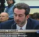
My name is Michael DeKort — I am a former system engineer, engineering and program manager for Lockheed Martin. I worked in aircraft simulation, the software engineering manager for all of NORAD, the Aegis Weapon System, and on C4ISR for DHS.
Key Industry Participation
- Lead — SAE On-Road Autonomous Driving SAE Model and Simulation Task
- Member SAE ORAD Verification and Validation Task Force
- Member DIN/SAE International Alliance for Mobility Testing & Standardization (IAMTS) Sensor Simulation Specs
- Stakeholder for UL4600 — Creating AV Safety Guidelines
- Member of the IEEE Artificial Intelligence & Autonomous Systems Policy Committee (AI&ASPC)
- Presented the IEEE Barus Ethics Award for Post 9/11 Efforts
My company is Dactle
We are building an aerospace/DoD/FAA level D, full L4/5 simulation-based testing and AI system with an end-state scenario matrix to address several of the critical issues in the AV/OEM industry I mentioned in my articles below. This includes replacing 99.9% of public shadow and safety driving. As well as dealing with significant real-time, model fidelity and loading/scaling issues caused by using gaming engines and other architectures. (Issues Unity will confirm. We are now working together. We are also working with UAV companies). If not remedied these issues will lead to false confidence and performance differences between what the Plan believes will happen and what actually happens. If someone would like to see a demo or discuss this further please let me know.
